This is the Arctic in a less refined mode, two settlements under the minimum decency and quality of life I've most oftenly showed here. For example, Napakiak does not have a piped water system - a striking contrast to the previous Solvorn post, but hey!, that's Norway...
Alaska - as well as Russia - has a lot to improve, mainly in its native villages and towns, to reach the living levels of other northernly regions elsewhere, mainly in Europe or Canada.
But anyway, one can always feel attracted to the high latitudes, to this northern landscape and lifestyle, and truly some improvement has been done. Let's have a look at the sub-arctic region of Bethel, by the Kuskokwim River, the second largest in Alaska after the Yukon River.

The Kuskokwim River flows westwards through southern Alaska to the Bering Sea. Both Napakiak and Napaskiak are located near its broad estuary.
Napakiak

Coordinates: 60° 41′ N, 161° 58′ W
Population: ~ 350

Napakiak is located at approximately 16 km downriver from Bethel, sitting on a lowland sandbar on the north bank of the Kuskokwim River. The Yup'ik Eskimos have lived in this region since 1000 A.D.


The sand island on which the village was built is severely eroding, and is prone to frequent and severe flooding due to ice jams and overflow.


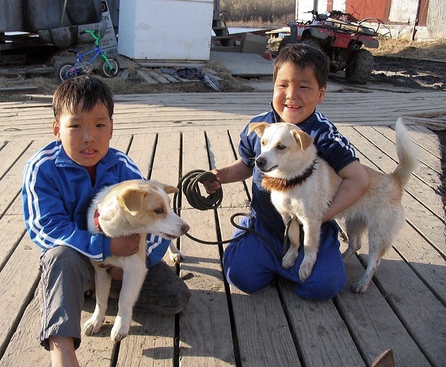
The village looks well kept. Most of the houses look as if they were recently painted.

A native-owned cooperative store opened in 1946. A Post Office was established in 1951. The National Guard post was built in 1960, and the first airstrip was completed in 1973.

There are presently two stores in Napakiak:


Traditional fishing is an important aspect of life in Napakiak; there are about 12 vessel owners. Salmon, sheefish, whitefish and lamprey abound in the nearby waters. Moose, bear and seal hunting provides meat.

No roads lead from/to Napaskiak ! But the river road is frequently used by Napakiak residents:


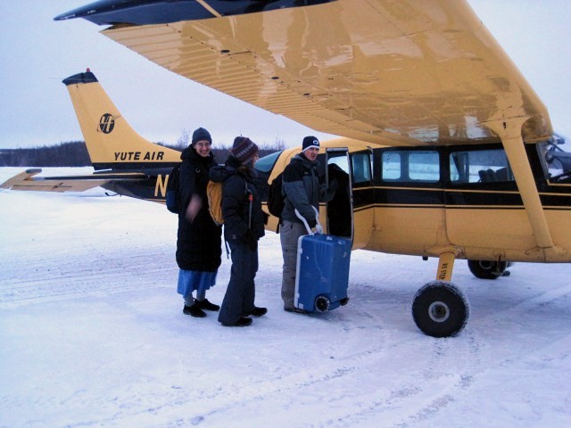
The isolation caused by the absence of roads is partly compensated by daily flights to other Alaskan towns; a flight to Napaskiak takes just 10 minutes ! ...

Napaskiak
Coordinates: 60° 42′ N, 161° 45′ W
Population: - 420
Napaskiak is another traditional Yup’ik village just 20 km east of Napakiak, on the oppostite east bank of the Kuskokwim river, seven miles southeast of Bethel, the region's main settlement.

There are no roads to or in Napaskiak (except winter ice-road), and there is also no running water ! Boardwalk connects everywhere - no streets or even house numbers, just slightly raised wood boards over the permafrost.

The school, local businesses and fisheries provide employment while subsistence activities (traditional fishing and hunting) supplement cash earnings.

Houses are raised on stilt-like beams of wood to be sturdy against the permafrost and rainwater. And so are too the school or the old orthodox church.

The entire (?) village is Russian Orthodox.


Residents have access to healthcare and shopping through short flights or boat travel to Bethel. There is a gravel airstrip and seaplane landing area that provides flight access year-round.
The Yukon-Kuskokwim rivers Park

The Kuskokwim river is a large river in Southwest Alaska. Its basin and its flow volume are quite remarkable. The name come from a Yup'ik word kusquqviim meaning 'big slow moving'.
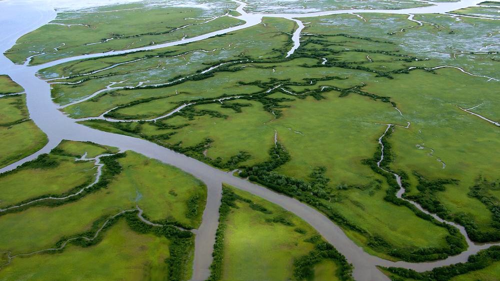

The southern portion of the Delta is a huge, swampy, treeless area comprising the muddy lowlands where two rivers (the Yukon and the Kuskokwim) drain into the ocean. A rich fauna - birds and fish, mainly - lives there.


